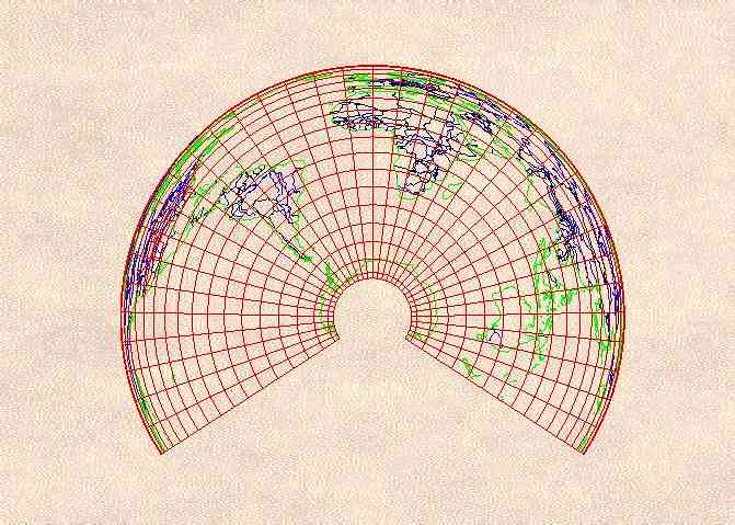
The Albers Equal Area Projection§ was first introduced by Heinrich Christian Albers of Lunebürg, Germany in 1805. It is a conic projection in which the distance between parallels is computed so that the scale east to west is the reciprocal of the scale north to south. Meridians are equally spaced radii of circles, parallels are unequally spaced arcs of those circles, and the poles are likewise represented as arcs.
On the map shown here, the standard parallels of 30ºS and 60ºS are chosen to optimize the presentation of the Southern Hemisphere, emphasizing the fact that the Atlantic, Pacific, and Indian Oceans, vast as they are, are yet merely lobes of one great World Ocean.
Projected inside AutoCAD® by Ptolemytm map projection software by W. Murray Sexton, from the Micro World Database, available from the Central Intelligence Agency.
§John P. Snyder, Map Projections--A Working Manual, U.S. Geological Survey Professional Paper 1395, United States Government Printing Office, Washington D.C., 1987, pp. 98-103..


Albers Equal Area Conic
Albers World Ocean Copyright © 1994 W. Murray Sexton


Scroll down for description.
Click East for next map.
Click North to return to list.