
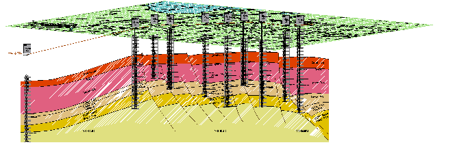
Three Dimensional Cross-Section Map
Cross-section of an oil field. The geologist correlates the electric logs for all wells and uses that information to create this interpretation of the subsurface. The names of the colored bands represent the geological age of the depicted features.
Copyright © 1995 SOMCO Corp.


Scroll down for description.
Click East for next map.
Click North to return to list.
Click on the map, then roll the scrolling wheel of your mouse to zoom in and out.
Click and Drag to pan.
Right Click for more options.